Mott MacDonald, working on behalf of the Environment Agency and Leeds City Council, developed a proof of concept for a ‘Woodland Carbon Calculator’ web tool to estimate carbon sequestration (stored carbon, see Figure 1) for new woodland creation. The tool was developed to incentivise woodland creation on the Leeds Flood Alleviation Scheme Natural Flood Management project which aims to plant up to 2 million trees throughout the catchment of the River Aire as a nature-based solution to reduce flood risk and enhance climate resilience in Leeds. The proof of concept tool was developed in collaboration with key industry stakeholders. It was produced to test our proposal to simplify the existing ‘Woodland Carbon Code’ spreadsheet calculator which is used to estimate carbon credits for new tree planting.
The Forestry Commission’s Woodland Carbon Code (see Figure 2) is the UK standard for woodland creation projects where claims are made about the carbon dioxide they sequester or ‘lock away’. The code provides a validation and verification scheme used to record woodland carbon units (or carbon credits). It uses a spreadsheet calculator (see Figure 3) to estimate the likely carbon units for different woodland planting, based on a variety of inputs including; the tree species, spacing and climatic factors which determine the rate of growth and yield of each tree.
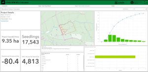
Whilst supporting our client during project scoping and development we identified that geographic information systems (GIS) could be used to manage project information and automate repetitive processes as part of the project’s drive to upscale natural flood management measures for implementation at a catchment scale. We applied our excellent skills and knowledge from developing a bespoke GIS platform for the project to create a ‘proof of concept’ web tool to simplify and semi-automate the manual spreadsheet calculator, to provide a rapid estimate of likely carbon sequestration for proposed woodland sites.
Our team then developed the web tool in ArcGIS Online, to link and automate the input and analysis of data for any proposed woodland location. A simple user interface was created using a concise questionnaire (see Figure 4), this streamlined the user input by grouping tree species for the woodland creation into pre-agreed mixes (suitable for the catchment) based on an agreed ‘project standard’. Computer code was written to automate query and calculation functions, based on GIS maps and external data sources used in the manual spreadsheet calculator. Finally, we developed an interactive dashboard (see Figure 5) to display the outputs in a simple and engaging format.
Through application of our web tool, and subsequently creating new woodland, we will promote financial investment in nature-based solutions. This will provide multiple benefits to society, including flood risk and climate resilience benefits for those living in Leeds. In addition, woodland creation delivers across a range of social outcomes; providing wider health and wellbeing benefits and creating empowered communities throughout the Aire catchment by creating jobs and increased access to blue-green spaces and nature, which in turn promotes recreational uses, tourism, increased public access and cultural activity.
