
Having been shortlisted in the digital innovation category at last year’s constructing excellence awards, the A-one+ GIS Integrated Area Programme has gone from strength to strength, following a successful innovation bid through Highways England’s innovation programme, the software has been invested in and further developed to achieve the holy grail of automated, network wide, analysis of optimal network occupancy.
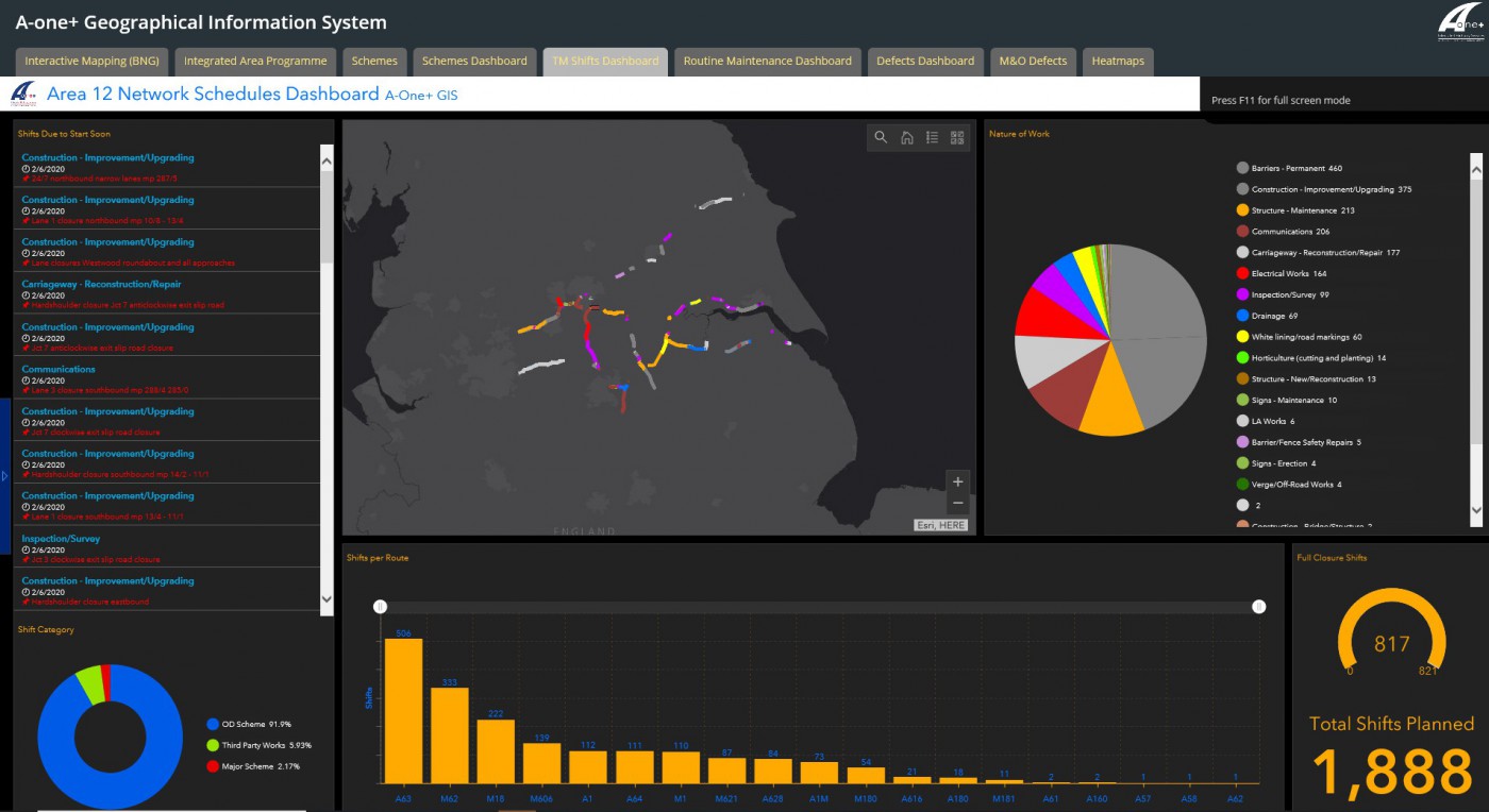
The IAP was already a tremendous success, by combining and automating multiple internal and external data sources together. This enabled the visibility of network occupancy / traffic management sharing opportunities throughout the Highways England Area 12 network. The front end, web-based GIS interface allowed the network occupancy datasets to be analysed in real time and the forward programme interrogated both spatially and temporally, for identifying and realising traffic management sharing opportunities.
Defect data was also overlaid to allow the assignment of defects based on priority and location, to enable traffic management to be utilised to its utmost potential every time by identifying defects which require repair within road closure extents.
An example video of the web-based GIS functionality of the GIS IAP can be seen here:
https://www.youtube.com/watch?v=ld0BFgjMHb8
The next step of the project was to take the automated data sources and introduce automated analysis of traffic management sharing opportunities, to further fine tune the software.
Following collaboration with miso (software developers), A-one+’ GIS Specialist Engineer identified FME server as a potential technology solution for the automated, network wide analysis, for the next stage of the IAP project. FME is a tool that is already being used by A-one+ and Highways England. This would allow the solution to be replicated across multiple areas/regions in the future and therefore create additional cost savings. Miso provided professional services to A-one+ as part of this project, with the core outputs being a series of FME workspaces that will replace the existing manual data analysis process of identifying traffic management sharing opportunities.
The new solution:
- Reads in multiple data sources containing future works/closures/network occupancy. This includes the Highways England Network Occupancy Management System (NOMS) data, A-one+ internal capital schemes database and maintenance and operations (M&O) routine maintenance annual tracker.
- Performs automated proximity and date analysis to identify activities occurring within a certain time and distance from each other.
- Produces standalone and database outputs that will assign a single, unique ‘sharing_ID’ and contain information/attributes from the network occupancy datasets for each individual traffic management sharing opportunity. Each sharing I.D has the potential to list the defects assigned to it which are relevant to that sharing I.D’s location.
- Produce outputs for non-GIS users.
- Send email alerts to inform relevant stakeholders of any new opportunities. • Send email alerts to inform relevant stakeholders if any of the previously identified sharing opportunities are no longer possible due to a change in time/location of an activity.
- As not all sharing opportunities are feasible, once a potential share has been agreed / dismissed, the opportunity will not be identified again unless a change in ‘activity’ occurs.
Evaluation of outcomes to evidence they are better than a traditional, less digital approach

Key achievements
- Digital, spatial, automation. All datasets can be viewed via a URL without the need for end users to have any specialist software or skills. All data sources and the network wide analysis of these data sources is automated every day, highlighting the traffic management sharing opportunities for us. This provides tremendous benefits during the key decision-making processes and ensures all our employees have the latest information at their fingertips.
2. The IAP turns data into information. The IAP answers key questions:
-
-
- Where are we planning to be?
- What are we planning to do?
- When are we planning to be there?
-
How can we maximise benefit from this information?
3. LEAN. This project is the epitome of LEAN working and digital construction done right. In this day and age, we want information. We want information accurate. We want information quickly. We want to action benefit from this information. The IAP successfully delivers these aims.